Geotechnical Investigation in Pakaur
 National Building Materials Laboratories the company with the quickest growth to provide geotechnical investigation in Pakaur. The best foundation for infrastructure projects is created via geotechnical investigation. The basis for our nation's future development was laid by NBML, a reputable geotechnical investigation organization in Pakaur. With the aid of cutting-edge soil testing tools and a highly skilled team of soil investigators, NBML Services has become the go-to service provider for projects not only in Pakaur but also from other parts of the nation.
Our geotechnical investigation in Pakaur team works on complicated stability issues, landslide prevention, off-shore and on-shore challenges of soil mechanics and rock mechanics, underground construction, ground improvement, and geo-environmental engineering. Our business uses an integrated strategy with clients to determine project requirements and carry out challenging geotechnical studies. Engineering geology, geotechnical engineering, soil research, and data analysis make up the key competencies of our team.
What is Geotechnical investigation?
Geotechnical investigation is the process of collecting and analyzing data about the physical properties of soil and rock beneath a proposed construction site. The goal of a geotechnical investigation in Pakaur is to provide information about the soil and rock conditions in order to design and construct safe and stable foundations for the proposed structure.Geotechnical investigation in Pakaur typically involves a combination of surface and subsurface exploration techniques, such as:
Soil Sampling: Soil samples are collected and analyzed in the laboratory to determine the soil type, density, and strength.
Penetration Testing: Cone penetration test (CPT), Standard penetration test (SPT) and other penetration test, which use a probe to measure the resistance of soil to penetration.
In-situ Tests: Test such as plate load test, pressure meter test, etc which are performed on site to measure the strength and compressibility of soil.
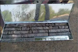
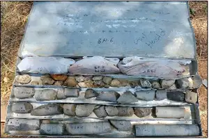
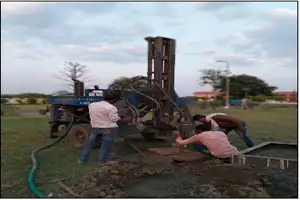
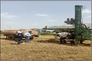
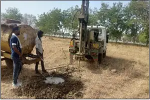
Borehole Drilling: Boreholes are drilled to a specified depth in order to collect soil and rock samples, and to observe soil and rock conditions in-situ.
Geophysical Tests: Geophysical tests such as Seismic refraction, Electrical resistivity, etc are used to get information on the subsurface without drilling.
Remote Sensing: Aerial photographs, satellite images, and other remote sensing data can be used to provide information about the surface conditions and to identify potential geotechnical hazards.
The results of a geotechnical investigation are used to design safe and stable foundations for the proposed structure, design retaining walls, slopes and embankment, identify potential hazards and to plan mitigation measures.
How Our Geotechnical Investigation in Pakaur Program Worked?
The geotechnical investigation in Pakaur programmed with respect to the project specifications (type of structure, difficulty of structure, expected ground conditions, data collection) including but not limited to: List of technical standards to be applied (geotechnical site investigation, drilling methods in soil / rock, sampling of soil / rock / groundwater, field testing, geotechnical laboratory testing of soil / rock / groundwater characteristics).
 Number, mapping / location, depth of boreholes.
 Soil and rock drilling & sampling methods (Soil Investigations)
 Number of standard penetration tests (SPT)
 Number of field vane shear tests.
 Number of disturbed and undisturbed soil samples.
 Number of undisturbed rock samples.
 Ground water sampling.
 Geotechnical laboratory testing Analysis
Benefits of Geotechnical investigation in Pakaur
Geotechnical investigation in Pakaur can provide several benefits, including:Identification of Soil and Rock Conditions: These services can help identify the type and characteristics of soil and rock at a construction site, which can inform the design of foundations and other structures.
Identification of Potential Hazards: Geotechnical investigations can identify potential hazards such as landslides, liquefaction, and sinkholes, which can help prevent damage to buildings and infrastructure.
Optimization of Design: Geotechnical information in Pakaur can be used to optimize the design of foundations and other structures, which can save time and money.
Compliance with Regulations: Geotechnical investigations are often required by building codes and regulations to ensure that structures are built on stable ground.
Improved Safety: Geotechnical investigation in Pakaur can help ensure that structures are built in a safe and stable manner, which can protect workers and the public.
Engineering Properties Tests (Determining Of Strength And Deformation Parameters)
Unconfined compression strength :- determination of the unconfined compressive strength of cohesive soil of the axial load.Consolidation test (one-dimensional consolidation properties): measuring the amount and rate of soil consolidation under gradually applied controlled-stress loading while the soil is constrained laterally and drained axially. The magnitude and pace of differential and total settling of a structure or earth fill are estimated using data from the consolidation test. This kind of estimations are important for the design of engineered structures and the performance assessment of those structures.
Test for strength and stress using consolidated undrained triaxial compression connections between strain and cohesive soil when the samples are isotopically consolidated and sheared in compression without drainage at a constant rate of axial deformation. The results of the undrained triaxial compression test are utilised in geotechnical engineering analysis to forecast how the material will perform in larger-scale geotechnical engineering applications. Predicting whether a slope would collapse or whether the soil will support the shear loads of the slope and stay in place would be an example of how to forecast the stability of soil on a slope. Such forecasts in engineering are made using undrained triaxial compression testing in conjunction with other tests.
Consolidation test (one-dimensional consolidation properties) - determining the magnitude and rate of consolidation of soil when it is restrained laterally and drained axially while subjected to incrementally applied controlled-stress loading. Data from the consolidation test are used to estimate the magnitude and rate of both differential and total settlement of a structure or earth fill. Estimates of this type are of key importance in the design of engineered structures and the evaluation of their performance.
Consolidated undrained triaxial compression test :- determination of strength and stress-strain relationships of cohesive soil when the specimens are isotopically consolidated and sheared in compression without drainage at a constant rate of axial deformation. Data from the undrained triaxial compression test are used in geotechnical engineering analysis to predict how the material will behave in a larger-scale geotechnical engineering applications. An example would be to predict the stability of the soil on a slope, whether the slope will collapse or whether the soil will support the shear stresses of the slope and remain in place. Undrained triaxial compression tests are used along with other tests to make such engineering predictions.
Rock testing parameter
 Porosity
 Specific Gravity
 Dry density
 Wet density
 Water absorption
 Compressive strength
 Dimension
 Point load

![Geotechnical Investigation in Pakaur - National Building Material Lab Geotechnical Investigation in Pakaur - National Building Material Lab]() LOAD TEST ON BRIDGES
LOAD TEST ON BRIDGES
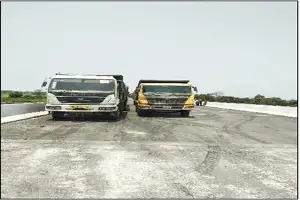
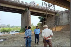
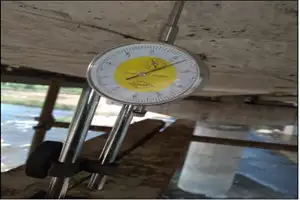
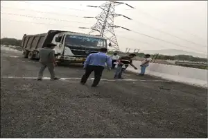 NBML is a top-tier technical lab for geotechnical investigation in Pakaur. By calculating the structure's live load capacity based on its present state using analysis and engineering methodologies, we provide load tests for bridges. Determine the safe load carrying capacity of structures through the process of conducting bridge load testing, which is a step in the inspection process. Bridge load testing is frequently used to identify problems that cannot be rectified with a simple visual inspection or study.
To address difficulties with a bridge or a population of bridges, finite element (FE)-based structural modelling, visual inspection, load testing, structural health monitoring (SHM), non-destructive testing (NDT), and structural health monitoring (SHM) are frequently used. As an illustration, AASHTO-MBE (2018) suggests load testing for the structural condition rating of concrete deck highway bridges. It may be necessary to conduct a load test on a specific bridge or a population of related bridges in order to make judgements on bridge closure, bridge load posting, replacement, and retrofit.

![Geotechnical Investigation in Pakaur - National Building Material Lab Geotechnical Investigation in Pakaur - National Building Material Lab]() PILE LOAD TEST
PILE LOAD TEST
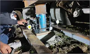 A variety of pile load testing services are provided by NBML as well as we are providing geotechnical investigation in Pakaur. The pile load test is the most accurate way for figuring out how much weight a pile can support. Either a test pile or a working pile serving as the foundation of the structure might be used for this test. One of the most popular techniques for determining a pile's real in-situ load capability is a pile loading test. The test procedure entails the precise measurement of pile head displacement in response to a physically applied weight. It is possible to test piles for lateral load, compression, or tension during this test.
 We have facilities for-
 Vertical (compression) load test
 Lateral load test
 Pull-out test
 Pile integrity test
 Dynamic load test


![Geotechnical Investigation in Pakaur - National Building Material Lab Geotechnical Investigation in Pakaur - National Building Material Lab]() PLATE LOAD TEST
PLATE LOAD TEST
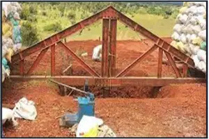
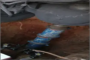
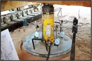
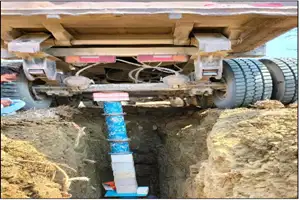
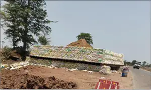 To ascertain the ultimate bearing capacity of the soil and settlement of the foundation under the loads for clayey and sandy soils, plate load tests are conducted on-site. Plate load testing is therefore useful for foundation selection and design. An appropriate safety factor is used to calculate safe bearing capacity.
Apparatus for plate load test on soil
 Mild Steel plate
 Hydraulic jack
 Reaction beam or reaction truss
 Dial gauges
 Excavating tools
![Geotechnical Investigation in Pakaur - National Building Material Lab Geotechnical Investigation in Pakaur - National Building Material Lab]() Bump integrator test (for roughness of surface)
Bump integrator test (for roughness of surface)
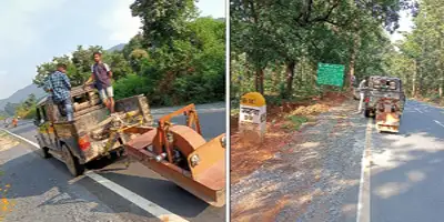 Surface evenness affects vehicle speed, comfort, vehicle operating cost and safety and hence needs to be require do this test after construct road/road pavement
![Geotechnical Investigation in Pakaur - National Building Material Lab Geotechnical Investigation in Pakaur - National Building Material Lab]() Earth resistivity test (E.R.T)
Earth resistivity test (E.R.T)
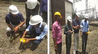 The soil's conductivity or resistance to electric current is measured by its soil resistivity. When designing systems that depend on current flowing through the Earth's surface, this is an important consideration. To build the grounding system in an electrical substation or for lightning conductors, it is vital to comprehend the soil resistivity and how it varies with depth in the soil. For substations and high-voltage direct current transmission systems, it is necessary for the design of grounding (earthing) electrodes. It was crucial for earth-return telegraphy in the past. It can also be used as a stand-in for a moisture content measurement in agriculture.
![Geotechnical Investigation in Pakaur - National Building Material Lab Geotechnical Investigation in Pakaur - National Building Material Lab]() TOPOGRAPHIC SURVEYORS
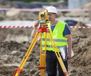
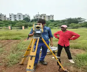
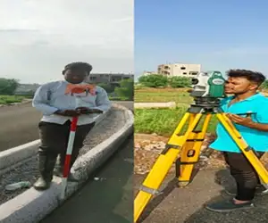
TOPOGRAPHIC SURVEYORS
NBML was a topographical survey specialist. To collect 3D observation data on location, it is done using an electronic total station. Topographic surveys are used to locate and map the contours of the ground and existing features on the Earth's surface or just above or below it. These features are depicted on the drawing as text, lines, and symbols.
![Geotechnical Investigation in Pakaur - National Building Material Lab Geotechnical Investigation in Pakaur - National Building Material Lab]()
![Geotechnical Investigation in Pakaur - National Building Material Lab Geotechnical Investigation in Pakaur - National Building Material Lab]()
![Geotechnical Investigation in Pakaur - National Building Material Lab Geotechnical Investigation in Pakaur - National Building Material Lab]()

 LOAD TEST ON BRIDGES
